Sunday, November 10, 2019

Veteran's Day Storm

My apologies for not giving this more of an rundown in advance of the storm. Tomorrow is all but certain now to be our first accumulating snow of the season for most if not all of Central Ohio.

The morning should actually start out dry and mild before getting squeezed between two competing air masses:


This animation is the best example of what we're up against for timing of the onset of snow tomorrow. In Southern Ohio it'll get in to the 60s out ahead of the front, while northern Ohio is already below freezing before daybreak.

But that dark blue line in the middle, at the end of the animation, is where the action will happen. And for us, it's all a matter of when that line pushes south, to determine when we move over to snow.

The temperature animation ends at 1pm, but we don't even see precip start until sometime after 3pm:

This is different from last week's storm because of how far the cold air advances before it even starts raining. There's even an outside chance that we have very little rain out of this storm, and cold air overruns the precip shield quick enough to hit us with snow early.

When the changeover happens, we could see periods of pretty heavy snow for the first couple of hours. That could allow rapid accumulation, even though our ground will still be fairly warm. Right now I think changeover will happen at or a little after sunset. This should be good news for the evening commute, as long as the system doesn't speed up.

That being said, here's our first snowfall map of the season:

This assumes a few hours of rain to start, followed by heavy snow for a couple hours before trailing off after midnight. If any of those variables change, so does this map.

I'll be posting on Twitter all day tomorrow, so be sure to follow me HERE

Wednesday, November 6, 2019

First Potential Snow - One Day Out

Now that we're within 24 hours of a potential snow, boy did a lot of people start speculating that we would get a decent accumulation out of this. Starting late last night in to midday today I saw a lot of posts saying, "models show accumulation tomorrow!"

Nothing's changed. So then why all the posts? Well, it's the first storm of the season, and high res models started to pick up the storm. So any model watchers immediately jumped at the first 30 hour model from the HRRR they saw.

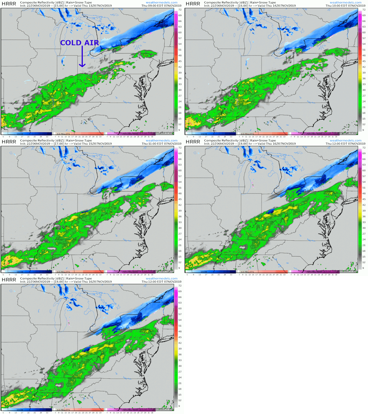
Our storm system is finally coming together tonight, with a southern and a northern stream on their way to merging over our area tomorrow:

The Forecast:
Expect scattered rain showers this evening before the storm really comes together in to widespread rain by tomorrow morning, sometime after rush hour. Then things get interesting.:

You'll notice at the end of the loop a small area of precip changing over to snow. That'll grow, but the real question will be how quick it changes over, and for how long before the precip ends.

Unfortunately I don't think the whole area sees accumulating snow, or even snow flakes at all. Western Ohio gets the transition with the cold air coming in there first, but as of right now it appears the precip moves out before the whole area can change over to snow.

Here's where I think we could see a light dusting of snow, on grassy surfaces:

Again, I still think this is a fluid situatuion, all dependent on when the snow changeover happens. I'll be posting pretty frequently on Twitter tomorrow.

Tuesday, November 5, 2019

First Potential Snow - 2 Days Out

Ah, the early season storm excitement might have all been for nothing. For the past couple of days, the weather models have been pretty consistent on giving us little if any in the way of the white stuff here in Central Ohio. While this isn't an official forecast, the Euro gives us a pretty good idea of what Thursday afternoon might look like:

That might be the saddest excuse of a backside snow that I've ever seen. It's not even on the backside of a deepening low, or even a Ridge Runner. No, this is just a regular looking boundary with cold air forcing itself in and causing a brief changeover before the precip ends.

On top of the weakness of this scenario, the timing isn't great either. A few days ago this looked like it had potential to change overnight Thursday in to Friday. Instead the storm seems to speed up and snow could fall in the afternoon. It's still too early in the season for our environment to be cold enough to support an event like this for accumulating snow, so right now we're going to be down to tracking this for our first chance of a dusting. I think our 1"> snow chances are pretty low.

I'll give a forecast tomorrow, with a snow map if needed.

Monday, November 4, 2019

First Potential Snow - 3 Days Out

It seems a little early in the season to be talking about it, but sure enough we have a chance for our first snow Thursday night.

The Setup:

A disturbance will drop down out of Canada and meet up with moisture from the Gulf around Oklahoma, setting up a true battle of cold and warm air, to determine if we get our first snow of the season.

As the storm moves across the country, high pressure and deep arctic air will settle to the north of the boundary. The strength and positioning of that cold airmass could ironically push the boundary far enough south to keep us out of the precip. Or, it could be shallow enough to allow warm air to win out and we get rain.

This, like so many boundary storms, will be all about location.

As we get closer, I'll be able to give you a better idea of what to expect as this storm bears down on us Thursday in to Friday. For now, keep your guards up for the potential for wintry weather.